This program includes a short theoretical introduction and regular fieldwork with faculty guidance. Data collected on the field course will be used in later parts of the module. The emphasis is on understanding the processes underpinning volcanism and eruption styles, and the interpretation of these processes from volcanic products.
radiometric dating of igneous and metamorphic rocks;
isotopic evolution of the Earth, origin and distribution of chemical heterogeneities in the mantle and evolution of continental crust;
pseudo-isochrons and mantle isochrons;
melt generation processes, timescales of storage and crystallization of magmas within the crust through micro-analytical elemental and isotopic profiles;
genesis of mafic igneous rocks;
genesis of granites;
genesis of ore deposits;
weathering of igneous rocks;
ocean floor metamorphism;
open-system evolution processes of magmas (crustal contamination, mixing) by means of combined radiogenic and stable isotopes;
characterization and modeling of magmatic sources in variable geodynamic contexts, both ancient and contemporaneous: mid-ocean ridges, ocean islands (hot spots), oceanic and continental subduction zones, continental flood basalts, potassic and ultrapotassic magmatic zones;
combined use of stratigraphy, geochronology, trace element and isotope variations (chemostratigraphy);
combined use of isotopes and trace elements in tephrostratigraphy and tephrochronology;
examples from worldwide magmatic areas.
The course will include a significant period of laboratory work during which the students will prepare and analyze some volcanic rock samples with the aim of producing isotope data that will be interpreted in combination with major and trace elements data.
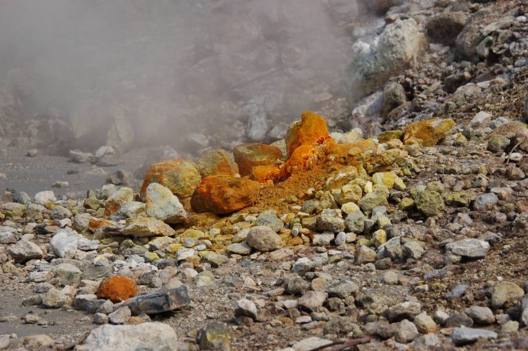
The second part of the course will describe: a) sources of contamination, hydrogeochemical behavior of contaminants, and hydrothermal and mineralization processes of groundwater in volcanic environments; b) natural and anthropogenic groundwater contaminations in volcanic environments and assessment methods of natural background values and threshold values for groundwater; c) classification of geothermal systems; d) use of volcanic groundwater as natural mineral and thermal waters; f) use of volcanic aquifers as low-enthalpy geothermal energy resources (open-loop and closed-loop geothermal systems with use of heat pumps in urban environments).
The course will deal with applications of radiogenic and stable isotope geochemistry in conjunction with major and trace-element geochemistry to a great variety of volcanological and petrological issues. The main applications will include:
radiometric dating of igneous and metamorphic rocks;
isotopic evolution of the Earth, origin and distribution of chemical heterogeneities in the mantle and evolution of continental crust;
pseudo-isochrons and mantle isochrons;
melt generation processes, timescales of storage and crystallization of magmas within the crust through micro-analytical elemental and isotopic profiles;
genesis of mafic igneous rocks;
genesis of granites;
genesis of ore deposits;
weathering of igneous rocks;
ocean floor metamorphism;
open-system evolution processes of magmas (crustal contamination, mixing) by means of combined radiogenic and stable isotopes;
characterization and modeling of magmatic sources in variable geodynamic contexts, both ancient and contemporaneous: mid-ocean ridges, ocean islands (hot spots), oceanic and continental subduction zones, continental flood basalts, potassic and ultrapotassic magmatic zones;
combined use of stratigraphy, geochronology, trace element and isotope variations (chemostratigraphy);
combined use of isotopes and trace elements in tephrostratigraphy and tephrochronology;
examples from worldwide magmatic areas.
The course will include a significant period of laboratory work during which the students will prepare and analyze some volcanic rock samples with the aim of producing isotope data that will be interpreted in combination with major and trace elements data.
The second part of the course will describe: a) sources of contamination, hydrogeochemical behavior of contaminants, and hydrothermal and mineralization processes of groundwater in volcanic environments; b) natural and anthropogenic groundwater contaminations in volcanic environments and assessment methods of natural background values and threshold values for groundwater; c) classification of geothermal systems; d) use of volcanic groundwater as natural mineral and thermal waters; f) use of volcanic aquifers as low-enthalpy geothermal energy resources (open-loop and closed-loop geothermal systems with use of heat pumps in urban environments).
The first part of the course will provide: a) an overview of the hydrogeological features of different volcanic systems (active and non-active, coastal, insular, peninsular and continental volcanic aquifers); b) conceptual models of groundwater flow in volcanic systems and its interactions with volcanoclastic materials (e.g. lavas, loose pyroclastics and tuffs, crystalline rock-aquifers); c) characterization of the hydraulic properties of porous and fractured volcanic aquifers and estimation methods; d) hydrogeochemical and isotopic characteristics (e.g. major and minor elements, heavy metals, gases) of volcanic groundwater and their use as natural tracers for groundwater monitoring.
The second part of the course will describe: a) sources of contamination, hydrogeochemical behavior of contaminants, and hydrothermal and mineralization processes of groundwater in volcanic environments; b) natural and anthropogenic groundwater contaminations in volcanic environments and assessment methods of natural background values and threshold values for groundwater; c) classification of geothermal systems; d) use of volcanic groundwater as natural mineral and thermal waters; f) use of volcanic aquifers as low-enthalpy geothermal energy resources (open-loop and closed-loop geothermal systems with use of heat pumps in urban environments).
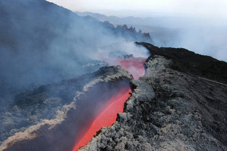
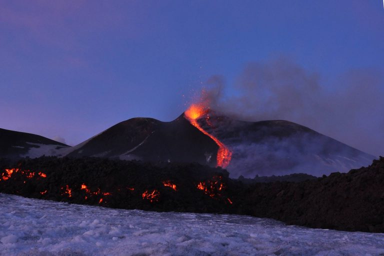
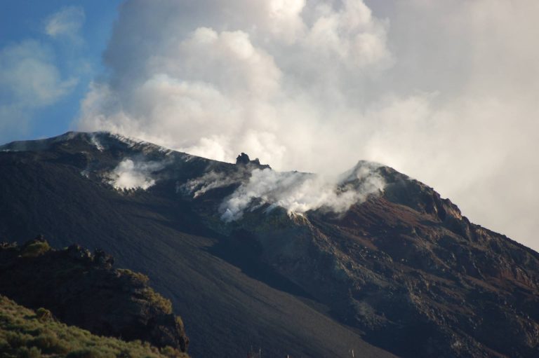
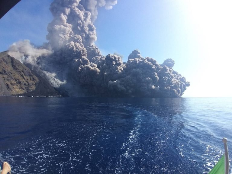
The probabilistic approach to volcanic hazard (PVHA) and eruption forecasting; physical modeling of the impact of volcanic eruptions (lava flows, ash dispersal, pyroclastic flows, gas emissions, volcano lakes, mud flows, tsunamis). The conditional PVHA: Eruption scenarios. Effects of eruptions on the health and the environment. The volcanic risk and the role of scientists. Examples from European and International volcanoes.
Despite their reputation as agents of destruction, explosive volcanoes are the most effective preservers of ancient human traces and their environmental context. Apart from providing valuable time markers, large-volume eruptions can quickly and thoroughly bury settlements and artifacts, soils and landforms, protecting them from subsequent damage. Many examples of unearthed important sites are present in Campania (i.e. the Bronze Age village of Nola and the Roman towns of Pompeii and Herculaneum) as in other part of the world. Their study can give an inestimable contribution to archaeological, historical and palaeo-environmental research.
The history of experimental petrology and the main techniques employed in the experimental study of magmatic processes: high-T furnace, quench and gas-mixing furnace, cold-seal vessel, internally heated gas vessel, piston cylinder, multi-anvil, diamond anvil etc. Experimental petrology and phase diagrams: the phase rule, two and three components systems and their petrological applications.
Introduction to Geographical Information System (GIS) and use of open-source GIS software. Introduction to proximal remote sensing monitoring techniques and their application. Elements of topography. Instruments and technologies for topographic survey: Total Station (TS), Terrestrial Laser Scanner (TLS), terrestrial photogrammetry, Unmanned Aerial Vehicle (UAV), GNSS techniques, thermography.
Introduction to satellite remote sensing techniques and its application. Interferometry SAR (InSAR) technique, Analysis and interpretation of multispectral data.
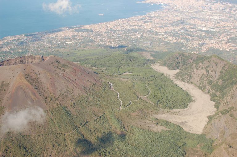
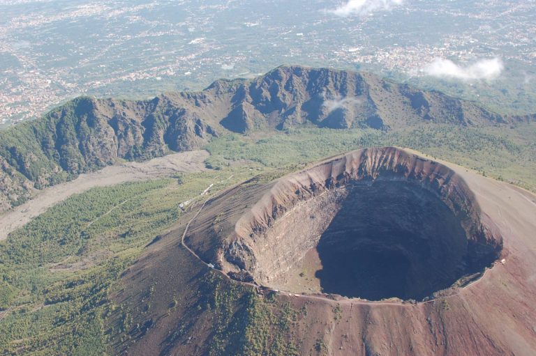
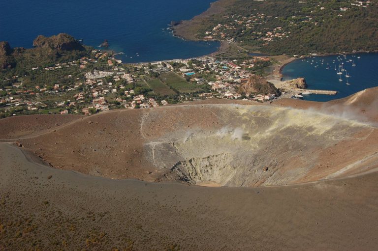
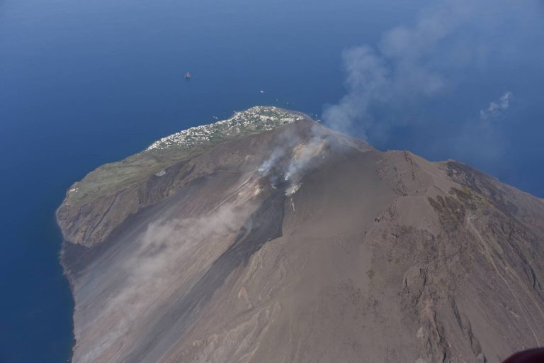
Main volcanic landforms and their evolution; reconstruction and morphometric characterization of monogenetic cones (tuff/cinder/scoria cone and rings) and complex volcanic edifices (basaltic plateaux, volcanic fields, shield volcanoes, strato-volcanoes, fissure volcanoes; calderas) by means of remote sensing and GIS-based morphometric analysis. Drainage on volcanoes and related erosion features and hazard. The volcanic landscape of Napoli and its surroundings: geomorphological and geoarchaeological evidence of interactions between humans and natural processes...
Classifications of slope movements. Landslide causes and triggers. Landslides typical of volcanic and peri-volcanic areas: role of matric suction. Methods for slope stability analyses. Landslide monitoring and remedial measures. Landslide susceptibility, hazard and risk.
Volcanotectonics is a multidisciplinary scientific field that joins the principles and methods of structural geology, tectonics, geodesy, and physics to volcanological research. Introduction to volcanotectonics. Methods of volcanotectonics (structural geology, models, remote sensing, geodesy). Deformation related to magmatic intrusion. Volcanotectonic processes: conditions for formation and propagation of dikes and sills. Formation of magma chambers and reservoirs. Deformation of volcanoes (faults in volcanic environments, caldera collapse, resurgence, sector collapse). Regional tectonic control on volcanism. Modelling of ground deformation. Use of Matlab and deformation models such as Mogi, Okada, and applications to case studies. Fieldtrip
