Despite their reputation as agents of destruction, explosive volcanoes are the most effective preservers of ancient human traces and their environmental context. Apart from providing valuable time markers, large-volume eruptions can quickly and thoroughly bury settlements and artifacts, soils and landforms, protecting them from subsequent damage. Many examples of unearthed important sites are present in Campania (i.e. the Bronze Age village of Nola and the Roman towns of Pompeii and Herculaneum) as in other part of the world. Their study can give an inestimable contribution to archaeological, historical and palaeo-environmental research.
The history of experimental petrology and the main techniques employed in the experimental study of magmatic processes: high-T furnace, quench and gas-mixing furnace, cold-seal vessel, internally heated gas vessel, piston cylinder, multi-anvil, diamond anvil etc. Experimental petrology and phase diagrams: the phase rule, two and three components systems and their petrological applications.
Introduction to Geographical Information System (GIS) and use of open-source GIS software. Introduction to proximal remote sensing monitoring techniques and their application. Elements of topography. Instruments and technologies for topographic survey: Total Station (TS), Terrestrial Laser Scanner (TLS), terrestrial photogrammetry, Unmanned Aerial Vehicle (UAV), GNSS techniques, thermography.
Introduction to satellite remote sensing techniques and its application. Interferometry SAR (InSAR) technique, Analysis and interpretation of multispectral data.
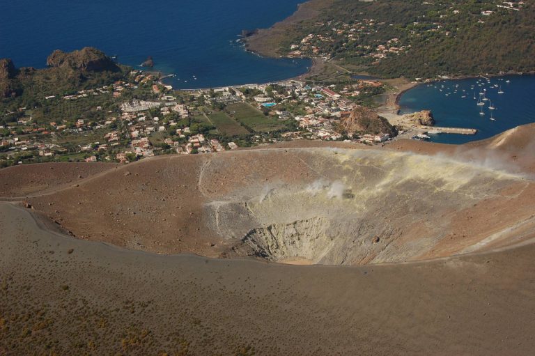
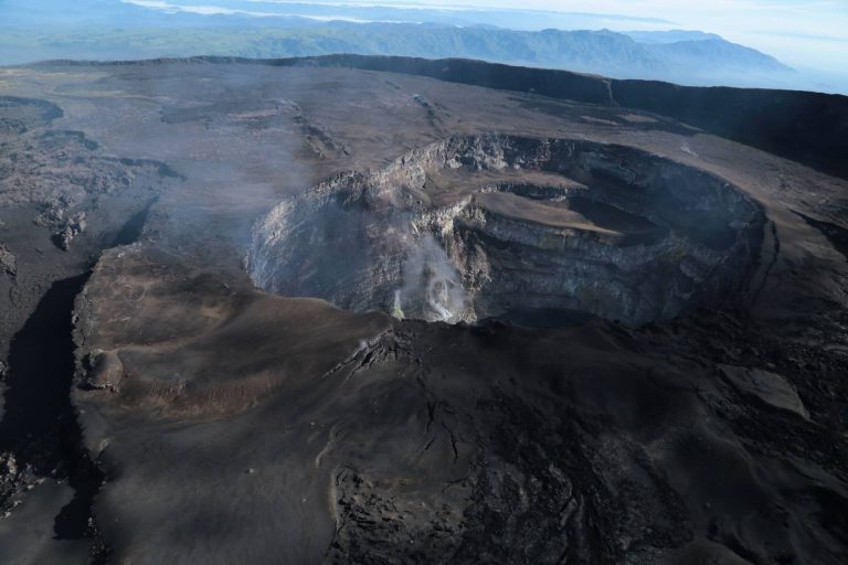
Main volcanic landforms and their evolution; reconstruction and morphometric characterization of monogenetic cones (tuff/cinder/scoria cone and rings) and complex volcanic edifices (basaltic plateaux, volcanic fields, shield volcanoes, strato-volcanoes, fissure volcanoes; calderas) by means of remote sensing and GIS-based morphometric analysis. Drainage on volcanoes and related erosion features and hazard. The volcanic landscape of Napoli and its surroundings: geomorphological and geoarchaeological evidence of interactions between humans and natural processes...
Classifications of slope movements. Landslide causes and triggers. Landslides typical of volcanic and peri-volcanic areas: role of matric suction. Methods for slope stability analyses. Landslide monitoring and remedial measures. Landslide susceptibility, hazard and risk.
Volcanotectonics is a multidisciplinary scientific field that joins the principles and methods of structural geology, tectonics, geodesy, and physics to volcanological research. Introduction to volcanotectonics. Methods of volcanotectonics (structural geology, models, remote sensing, geodesy). Deformation related to magmatic intrusion. Volcanotectonic processes: conditions for formation and propagation of dikes and sills. Formation of magma chambers and reservoirs. Deformation of volcanoes (faults in volcanic environments, caldera collapse, resurgence, sector collapse). Regional tectonic control on volcanism. Modelling of ground deformation. Use of Matlab and deformation models such as Mogi, Okada, and applications to case studies. Fieldtrip
Bayesian and Frequentists probabilistic framework in stochastic modeling and inverse problems; Review of linear algebra, statistical, differential equations, solutions of fundamental equations; Data analysis and hypothesis testing; Basic MATLAB programming.
The methods of Applied Geophysics (their classification and applications): airborne and ground magnetic, electromagnetic and gravity surveys, satellite remote sensing, GPS network, and resistivity and seismic surveys. Procedures and techniques of prospections and organization of a geophysical survey in volcanic areas. Potential field methods (gravimetric and magnetometric). Electrical methods (direct current resistivity, induced polarization). Electromagnetic methods (with controlled source FD). Seismic methods (refraction and reflection). Other methods and integration of geophysical methods. Hints on processing, filtering, and single and joint inversion of geophysical data. Critical geophysical targets include the inner volcanic structure, the identification of shallow reservoir systems, changes in active hydrothermal systems, the deep thermal deformation sources and the temporal evolution of the volcanic system.
Fundamental Equations and their solutions. Body and surface waves properties. Seismic signals and their classification. Sources and waves propagation features. Focal mechanisms and Moment Tensor. Seismic Energy: definition and measurements. Earthquakes Statistics. Seismometry. Seismic networks - Positioning, Earth rotation and orientation, Gravity Field, IGS GPS/GNSS Network, Measurements Systems: GPS, InSar ambiguity and resolution, Strain Tensor, Source models
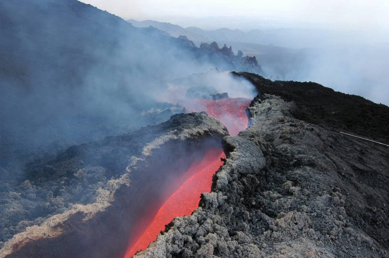
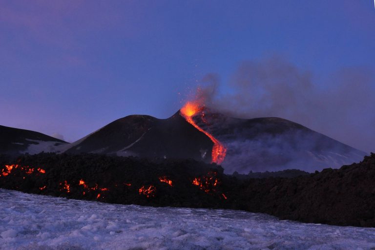
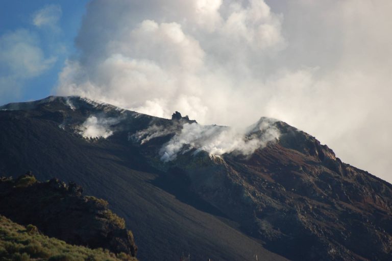
Advanced Volcanology: The principles of magma discharge, degassing and fragmentation and their control on eruption mechanisms. Classification schemes for common eruption types and styles
